Within Weather
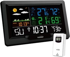
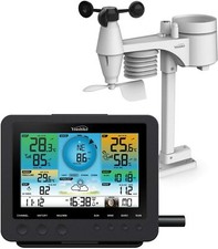
Why the weather station belongs on site
A weather station beside the detector can capture local gusts, fog, cloud and lens conditions that distant reports miss.
On this page
- The distance problem in nearest station weather lookups
- Matching weather cadence to short UAP events
- What a detector side weather record should preserve
Page outline Jump by section
Introduction
For an automated instrumented UAP detector, the most useful weather record is usually the one measured at the detector itself rather than the nearest official weather station. This is not because national meteorological networks are unreliable, but because they are designed to represent conditions at their own observing sites. A camera monitoring the sky from a hilltop, coastline or urban rooftop may experience very different wind, visibility, cloud or humidity from an airport several kilometres away. When an unusual aerial event lasts only a few seconds, those local differences can determine whether an observation is interpreted correctly or remains ambiguous.
 A detector-side weather station therefore strengthens the evidential value of a UAP record. It provides environmental measurements that are synchronised with the instrument, allowing later investigators to compare the detected object with the exact atmospheric conditions through which the sensor was operating rather than relying on approximate regional reports. This complements, rather than replaces, official meteorological observations. [World Meteorological Organization+2RMetS]community.wmo.int8)VOLUME I, MEASUREMENT OF METEOROLOGICAL VARIABLES; Chapter 1, General; Chapter 2, Measurement of temperature; Chapter 3, Measurement…
The distance problem in nearest-station weather lookups
The phrase “nearest weather station” often gives a false sense of precision. The closest official observing site may be many kilometres away, at a different elevation, beside an airport, or in terrain unlike the detector location.
Meteorological organisations distinguish between observations that are representative of a specific observing site and those intended to describe broader regional conditions. Station siting standards exist precisely because exposure, nearby obstacles, ground cover and local terrain all influence measurements. A weather report is therefore most representative of its own surroundings, not necessarily every location nearby. [World Meteorological Organization+2World Meteorological Organization]community.wmo.int8)VOLUME I, MEASUREMENT OF METEOROLOGICAL VARIABLES; Chapter 1, General; Chapter 2, Measurement of temperature; Chapter 3, Measurement…
For UAP investigations, several common situations illustrate the limitation:
- A coastal detector may experience sea fog while an inland airport reports clear conditions.
- A hillside camera may record strong gusts generated by terrain even though valley winds remain light.
- Urban rooftops can experience turbulence and thermal effects absent from nearby rural stations.
- Shallow low cloud or mist may affect one observing site but not another only a few kilometres away. [RMetS+2weather.gladstonefamily.net]rmets.orgwhy weather conditions can change over short distances7 May 2026 — The nearest weather station offers useful information, but it may…
None of these situations imply that the official report is incorrect. Instead, they demonstrate that two accurate observations can legitimately describe different local environments at the same time.
For this reason, using only remote weather reports to explain or support a UAP observation introduces uncertainty that cannot easily be quantified afterwards.
Matching weather cadence to short UAP events
Spatial differences are only part of the problem. Timing matters just as much.
Many reported aerial events last from a few seconds to a few minutes. Official weather observations often follow schedules established for aviation or climatology rather than continuous event logging. Automated Weather Observing Systems (AWOS) commonly issue reports every 20 minutes, while ASOS systems provide routine observations and can generate special reports when weather crosses operational thresholds. Those thresholds are designed for aviation safety, not for documenting every brief environmental fluctuation relevant to an optical sensor. [NCEI+2National Weather Service]ncei.noaa.govMore Information.Read moreAutomated Surface/Weather Observing Systems (ASOS/AWOS)March 22, 2021 — They generally report at 20-minute intervals and, unlike ASOS…
A detector-side station can instead:
- record continuously or at high sampling rates;
- timestamp every measurement with the same clock used by the cameras;
- preserve transient gusts, humidity spikes or rapid visibility changes;
- associate environmental measurements directly with the detected object.
This temporal alignment is especially valuable when analysing apparent acceleration, intermittent visibility or sudden changes in object brightness. If a brief fog bank, passing cloud fragment or wind gust occurred at exactly the same moment, investigators can evaluate whether it plausibly influenced the observation.
Without synchronised local measurements, analysts must interpolate between routine weather reports that may have been issued before or after the event.

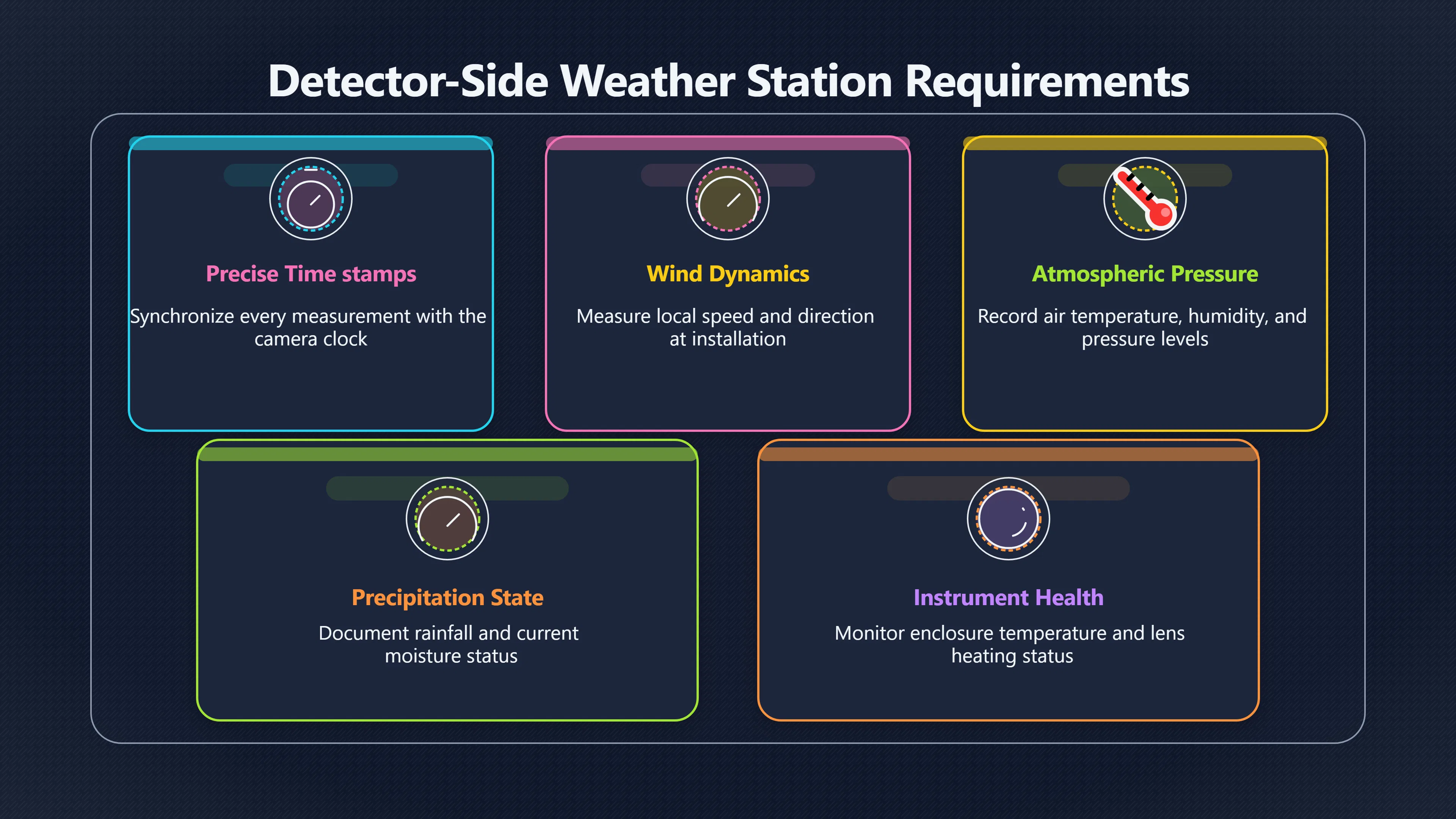
What a detector-side weather record should preserve
The objective is not to build a full meteorological observatory. Instead, the weather station should document the conditions most likely to influence sensor performance and aerial interpretation.
A practical detector-side record should preserve:
- precise timestamps synchronised with every sensor;
- wind speed and direction measured at the installation;
- air temperature, humidity and pressure;
- rainfall or precipitation state;
- visibility or indicators of reduced transparency where practical;
- cloud information, whether from dedicated sensors or derived sky imagery;
- instrument health indicators such as enclosure temperature, lens heating status or condensation detection.
The last category is often overlooked. Some apparent anomalies originate from the observing system rather than the atmosphere itself. Recording enclosure humidity, heater operation or evidence of lens moisture allows investigators to distinguish atmospheric effects from optical artefacts produced within the instrument.
Why local weather improves later analysis
A local weather archive provides several analytical advantages that remote reports cannot fully supply.
First, it improves reconstruction. When reviewing a historical event months later, investigators can examine the environmental conditions exactly where the detector operated rather than estimating them from distant stations.
Second, it enables better correlation between independent sensors. If multiple cameras, microphones or radio receivers recorded an event simultaneously, matching local weather measurements help determine whether changes appeared across all instruments or only those sensitive to particular atmospheric conditions.
Third, it reduces confirmation bias. Analysts are less likely to search selectively for nearby weather reports that appear to support a preferred explanation if a complete detector-side environmental record already exists.
Finally, local weather measurements can be compared with regional observations rather than replacing them. Differences between the two datasets may themselves become informative, revealing local fog formation, terrain-driven wind or other microscale conditions affecting only the detector site. [World Meteorological Organization+2RMetS]community.wmo.int8)VOLUME I, MEASUREMENT OF METEOROLOGICAL VARIABLES; Chapter 1, General; Chapter 2, Measurement of temperature; Chapter 3, Measurement…

Using official reports alongside local sensors
Co-located weather stations should not be viewed as competitors to national meteorological services.
Official observations remain essential because they provide broader environmental context, upper-air information, aviation reports, satellite integration and quality-controlled long-term records. They can reveal approaching fronts, regional wind fields or weather systems extending far beyond a single detector.
The strongest evidence comes from combining both sources:
- Detector-side measurements establish exactly what the instruments experienced.
- Nearby official stations provide regional consistency checks.
- Upper-air observations and forecasts help evaluate conditions above the surface, particularly for objects at significant altitude.
This layered approach produces a more complete environmental record than either source alone. For automated instrumented UAP detectors, the local weather station therefore functions as an integral part of the observing system, preserving the immediate atmospheric context that distant reports are often unable to capture.
Amazon book picks
Further Reading
Books and field guides related to Why the weather station belongs on site. Use these as the next step if you want deeper reading beyond the article.
The AMS Weather Book
Helps readers understand atmospheric conditions that influence observational evidence.
Observing Handbook and Catalogue of Deep-Sky Objects
Provides practical observing techniques relevant to documenting transient sky events under varying conditions.
The Weather Handbook
Covers weather interpretation useful when comparing detector-side measurements with broader meteorological reports.
Meteorology today
First published 1982. Subjects: Meteorology, Textbooks, Meteorologia, Meteorologie, Météorologie.
eBay marketplace picks
Marketplace Samples
Example marketplace items related to this page. Use the search link to explore similar finds on eBay.
Endnotes
-
Source: rmets.org
Link: https://www.rmets.org/metmatters/mystery-microclimates-why-weather-conditions-can-change-over-short-distancesSource snippet
why weather conditions can change over short distances7 May 2026 — The nearest weather station offers useful information, but it may...
Published: May 2026
-
Source: weather.gladstonefamily.net
Link: https://weather.gladstonefamily.net/UrbanMetOps.pdfSource snippet
WORLD METEOROLOGICAL ORGANIZATION...by MOATU SITES — Instead it is recommended to site urban stations over surfaces that, within a micro...
-
Source: ncei.noaa.gov
Title: More Information.Read more
Link: https://www.ncei.noaa.gov/products/land-based-station/automated-surface-weather-observing-systemsSource snippet
Automated Surface/Weather Observing Systems (ASOS/AWOS)March 22, 2021 — They generally report at 20-minute intervals and, unlike ASOS...
Published: March 22, 2021
-
Source: weather.gov
Link: https://www.weather.gov/media/asos/aum-toc.pdfSource snippet
National Weather ServiceAutomated Surface Observing System (ASOS)This system is the primary surface weather observing system in the Unite...
-
Source: weather.gov
Link: https://www.weather.gov/media/epz/mesonet/CWOP-WMO8.pdfSource snippet
anization (WMO) is to coordinate the activities of its 188 Members in the generation of data and.Read more...
-
Source: community.wmo.int
Link: https://community.wmo.int/site/knowledge-hub/programmes-and-initiatives/instruments-and-methods-of-observation-programme-imop/guide-instruments-and-methods-of-observation-wmo-no-8Source snippet
8)VOLUME I, MEASUREMENT OF METEOROLOGICAL VARIABLES; Chapter 1, General; Chapter 2, Measurement of temperature; Chapter 3, Measurement...
-
Source: community.wmo.int
Title: World Meteorological Organization Siting Classification
Link: https://community.wmo.int/site/knowledge-hub/programmes-and-initiatives/instruments-and-methods-of-observation-programme-imop/siting-classificationSource snippet
Classification - WMO Community PlatformThe Siting Classification for Surface Observing Stations on Land is the first common ISO/WMO stand...
-
Source: rmets.onlinelibrary.wiley.com
Link: https://rmets.onlinelibrary.wiley.com/doi/10.1002/joc.8406Source snippet
Royal Meteorological SocietyClimatological reference stations: Definitions and requirements5 Mar 2024 — The station shall be located at a...
-
Source: weather.metoffice.gov.uk
Link: https://weather.metoffice.gov.uk/learn-about/how-forecasts-are-made/observations/observation-site-classificationSource snippet
Observation site classificationThere are minimum siting and exposure standards to adhere to, to ensure conformance and data validity, and...
-
Source: community.wmo.int
Title: int Knowledge-sharing Portal
Link: https://community.wmo.int/site/knowledge-hub/programmes-and-initiatives/instruments-and-methods-of-observation-programme-imop/knowledge-sharing-portalSource snippet
wmo.intKnowledge-sharing Portal - WMO CommunityPurpose of this web portal is to enable Members to share their experience and knowledge on...
Additional References
-
Source: researchgate.net
Link: https://www.researchgate.net/publication/265347633_Initial_guidance_to_obtain_representative_meteorological_observations_at_urban_sitesSource snippet
Initial guidance to obtain representative meteorological...23 Dec 2015 — This IOM Report is therefore an important tool for early dissem...
-
Source: uncclearn.org
Link: https://www.uncclearn.org/wp-content/uploads/library/wmo107.pdfSource snippet
Guidance on Climate Observation Networks and SystemsAt a minimum such stations should make observations of the following elements: weathe...
-
Source: campbellsci.co.uk
Link: https://www.campbellsci.co.uk/aviationSource snippet
ICAO compliant aviation weather solutions that...You can acquire visibility, present weather, and cloud information with an aviation weat...
-
Source: skybrary.aero
Link: https://skybrary.aero/articles/weather-observations-aerodromesSource snippet
Weather Observations at AerodromesMETAR reports are provided at regular intervals (usually 30 minutes) and provide essential weather info...
-
Source: researchgate.net
Link: https://www.researchgate.net/publication/392184489_Climate_walking_A_comparison_study_of_mobile_weather_stations_and_their_relevance_for_urban_planning_design_human_health_and_well-beingSource snippet
Climate walking: A comparison study of mobile weather...30 May 2025 — In this paper, the study compares two microclimate mobile weather...
Published: May 2025
-
Source: campbellsci.com
Link: https://www.campbellsci.com/weather-station-sitingSource snippet
1.5 m ± 1 m (AASC); 1.25 to 2.0 m (WMO); 2.0 m for temperature only (EPA); 2 m & 10 m for temperature difference (EPA)...
-
Source: robust-analytics.com
Title: nasa selects robust analytics for innovative urban weather station research
Link: https://robust-analytics.com/2025/08/06/nasa-selects-robust-analytics-for-innovative-urban-weather-station-research/Source snippet
NASA selects Robust Analytics for innovative urban...6 Aug 2025 — When deployed, the weather station network would provide weather situa...
-
Source: hypermeteo.com
Title: Quaderno Meteorologia Aperta1 Representativeness precision Meteorology 1
Link: https://www.hypermeteo.com/wp-content/uploads/2022/02/Quaderno_Meteorologia_Aperta1_Representativeness_precision_Meteorology-1.pdfSource snippet
(2006). Initial Guidance to Obtain Representative Meteorological Observations at Urban Sit. (WMO/TD-No. 1250; IOM Report-No. 81). Geneva...
-
Source: youtube.com
Link: https://www.youtube.com/watch?v=ZOt88Uzr2OQSource snippet
Understanding Weather Station ModelsIn this video, we explore how to read, create, and decode weather station models using the diagram fr...
-
Source: researchgate.net
Link: https://www.researchgate.net/figure/The-surrounding-environments-of-four-weather-stations-a-the-weather-station-under-the_fig3_299274681Source snippet
y analyzing possible correlations between the variables that influence the urban...Read more...
Topic Tree